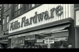
Tax assessment records help accurately date a building's construction and disclose its original owner and list of occupants.
Land assessment and tax assessment records combined allow you to determine the original owner and occupant of the property, as well as the date on which the structure was built. Please note not all buildings are tax-assessed. Public and institutional buildings, such as churches and schools, may not be found on tax assessment records. If they are used for a purpose other than their original use, such as a school that has been converted into a house, it will be assessed only from when it was converted. Before the construction of a building, the vacant lot is listed by lot number.
The following is a list of former municipalities in Hamilton and the Note: Since the amalgamation assessment rolls are available on microfilm at Local History and Archives.
Ancaster: not available
Barton Township: After annexation (1960), see Hamilton assessment rolls. Pre-1960 not available.
Beverly Township: 1837-1954
Binbrook: 1854-1970
Dundas: 1835-1942
East Flamborough: 1840-1960
Flamborough: not available
Glanbrook: not available
Glanford: 1840-1957
Hamilton: 1834-1899 [with some gaps]
These records are organized by Ward (name or number). For a listing of historic wards see the “City of Hamilton Ward Boundary Maps, 1813-1985” (R346.713045 KIN) to determine the Ward where your property can be found..
Stoney Creek: not available
Waterdown: 1880-1959
West Flamborough: 1861-1960
Note: Several areas in Hamilton were previously part of other jurisdictions. West Hamilton was originally part of Ancaster Township, while east Hamilton and the Mountain were originally part of Barton Township. Aldershot was annexed by the then Town of Burlington in 1958. It had previously been an unincorporated village in East Flamborough Township. Aldershot was annexed by the then Town of Burlington in 1958. It had previously been an unicorporated village in East Flamborough Township.
Here are some maps and recourses that can help identify previous townships, jurisdications, or wards.
Plan of Hamilton, 1875
Portion of the Hamilton and North Western Railway and Connections, 1880
Map of Wentworth County, 1920, via McMaster University